

4 The Waterpocket Fold
Central Utah Summer 2015Aerial Photography Using Drones
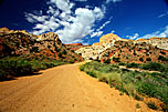
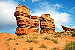
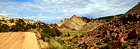
The Waterpocket Fold is an immense distortion in the earth’s surface (probably caused by the collision of tectonic plates) which caused deeply-buried layers of stone to tilt upward at grotesque angles (as seen in the last two items here). It also raised an enormous wall running North/South which gleams in the Sun.
After thirty miles of crossing the desert the Notom Road meets the Burr trail, with the Burr coming to the top of the escarpment and the Notom Road arriving at the bottom. The Notom continues on to Bullfrog, near Lake Powell.
 |
|
 |
 |
 |
Carl Roessler
P.O. Box 33668
Las Vegas, NV 89133
voice: 702.562.0226
fax: 702.562.0227
| Return to Home Page | E-mail Carl Roessler: divxprt@cox.net | Photos |
|---|
All material in this Web Site is Copyright © Carl Roessler
2023 - All rights reserved.
Maintenance by Patricia
of Visual Ad Worx
Modified 11.08.23